By Pepper Fisher
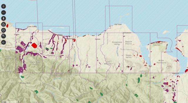
OLYMPIA – The Washington Department of Natural Resources has developed a map that gives residents an idea of which areas around the state could be susceptible to landslides.
Click here to look at the map.
The map dials down to specific neighborhoods, including many here in Port Angeles and throughout Clallam County.
The storms and subsequent landslides of mid-November and early December in Clallam County reminded us of the dangers of saturated soil. Washington is one of the most landslide-prone states in the country, to the degree that the Washington Department of Transportation routinely budgets $15 million a year for cleanup of landslides on highways.
The DNR website lists the warning signs of a potential landslide, which include:
- New or developing cracks, mounds, or bulges in the ground.
- Sagging or taut utility lines; leaning telephone poles, deformed fences, or tilting of trees on a hillside.
- Sticking windows or doors; growing cracks in walls, ceilings, or foundations.
- Changes in water well levels or water wells that suddenly run dry.